PhotographAA-0186
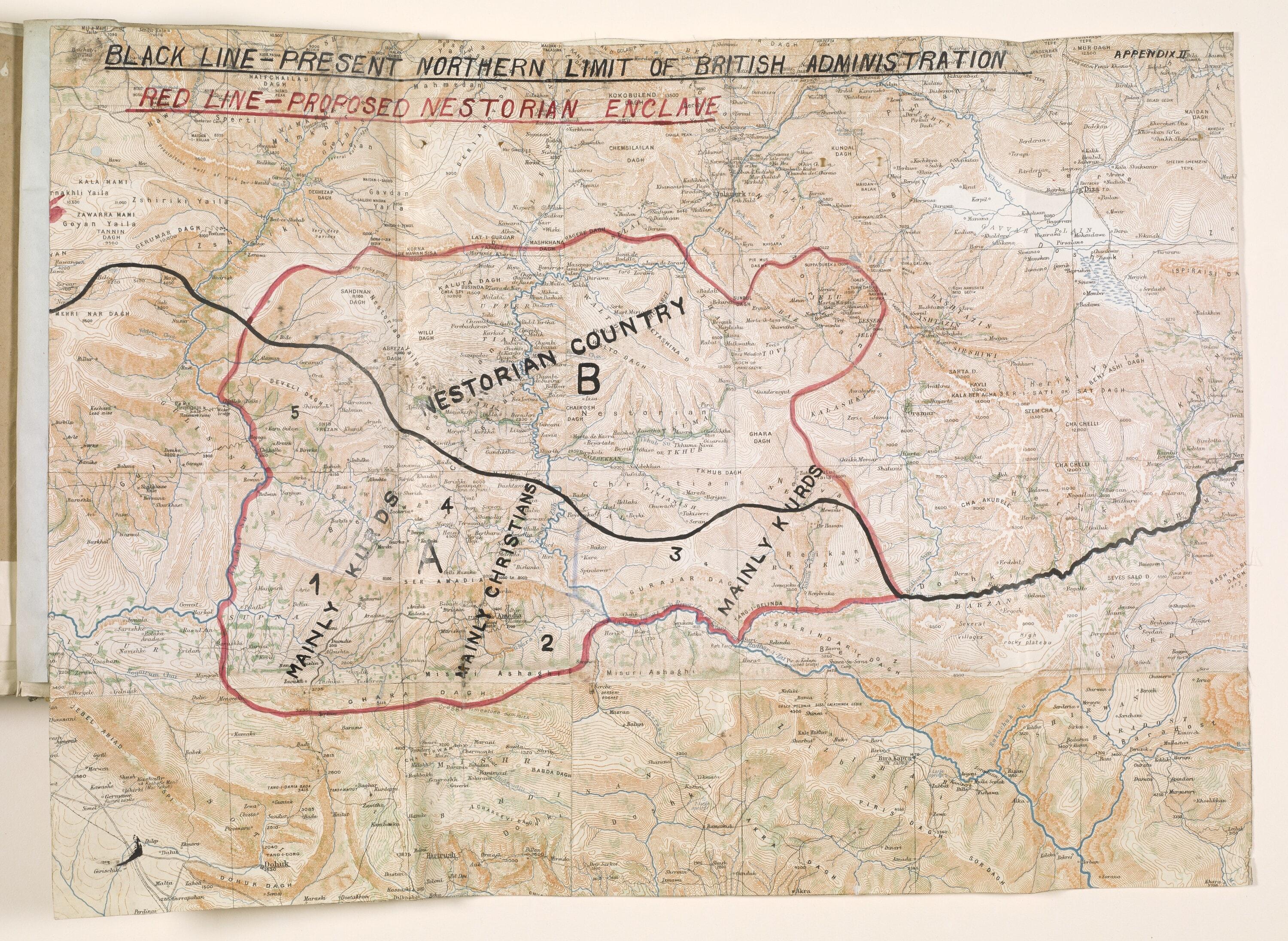
Map of a proposed Nestorian (Assyrian) enclave north of Mosul, about 1920
Printed relief map of the mountains north of Mosul, hand-annotated in red and black ink to show a "Proposed Nestorian Enclave" straddling the northern limit of British administration, with the northern part marked "Nestorian Country" and zones marked "Mainly Kurds" and "Mainly Christians".
Do you recognize someone or something here?Names, places and family stories help us describe this photo properly.Source
Qatar Digital Library (British Library: India Office Records and Private Papers)
Unknown · Qatar Digital Library usage terms: "Public Domain".